Empowering law enforcement with street-level threat intelligence
Get standardized crime and unrest data covering 99% of US territory and 5000+ global cities. Replace hours of manual analysis with instant operational intelligence based on threat analytics, forecasting, and risk scoring that gives you a common operating picture across jurisdictions.
Heading 1
Heading 2
Heading 3
Heading 4
Heading 5
Heading 6
Lorem ipsum dolor sit amet, consectetur adipiscing elit, sed do eiusmod tempor incididunt ut labore et dolore magna aliqua. Ut enim ad minim veniam, quis nostrud exercitation ullamco laboris nisi ut aliquip ex ea commodo consequat. Duis aute irure dolor in reprehenderit in voluptate velit esse cillum dolore eu fugiat nulla pariatur.
Block quote
Ordered list
- Item 1
- Item 2
- Item 3
Unordered list
- Item A
- Item B
- Item C
Bold text
Emphasis
Superscript
Subscript
.avif)


Resource Deployment

Site Assessment

Personnel Safety

Investigations
Scattered, inconsistent threat data creates intelligence gaps that compromise operations
Data chaos delays action
Your analysts waste 70% of their time hunting for data across inconsistent, scattered sources so emerging threats in critical locations get missed.
Boundaries create blind spots
Jurisdictional boundaries create coordination delays that limit effective planning. Threats evolve fast while your agencies are stuck manually sharing data.
Incident response, not prevention
Without pattern analysis tools, agencies stay locked in reactive mode. You can't deliver the predictive insights you need to justify resource deployment.

Make fast, data-driven decisions about where law enforcement resources are needed most
Assess threats 5x faster with data you can compare across jurisdictions.
Search any address in 99% of US territory and 5,000+ global cities. Export location threat assessments in seconds for briefings and operational planning. Stay ahead of emerging threats, no matter the jurisdiction, with bi-weekly refreshes of crime and unrest data available everywhere.


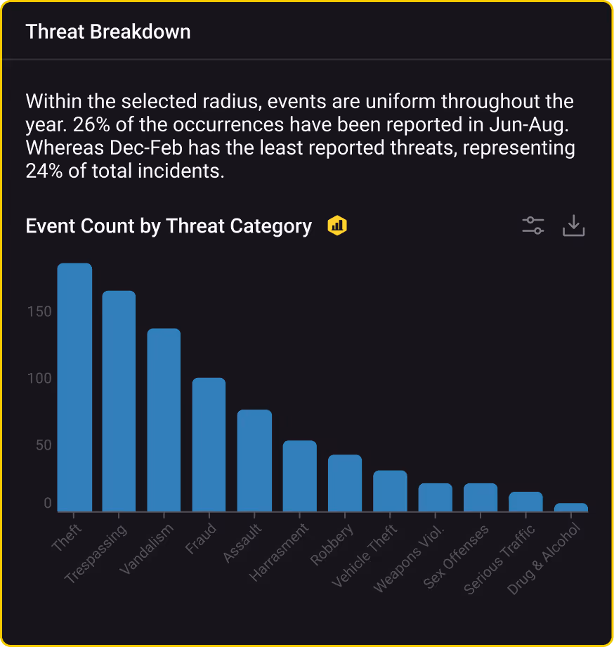


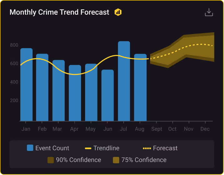

Spot patterns in maps and analytics that you miss in raw spreadsheets.
Turn 10 hours of spreadsheet hunting into 10 minutes of interactive analysis. Use heat maps showing crime clusters. Track temporal patterns by time of day and season to optimize patrol schedules. Identify emerging threats before incident counts spike. Create stakeholder-ready intelligence products with maps, charts, and trend graphs in minutes instead of hours.
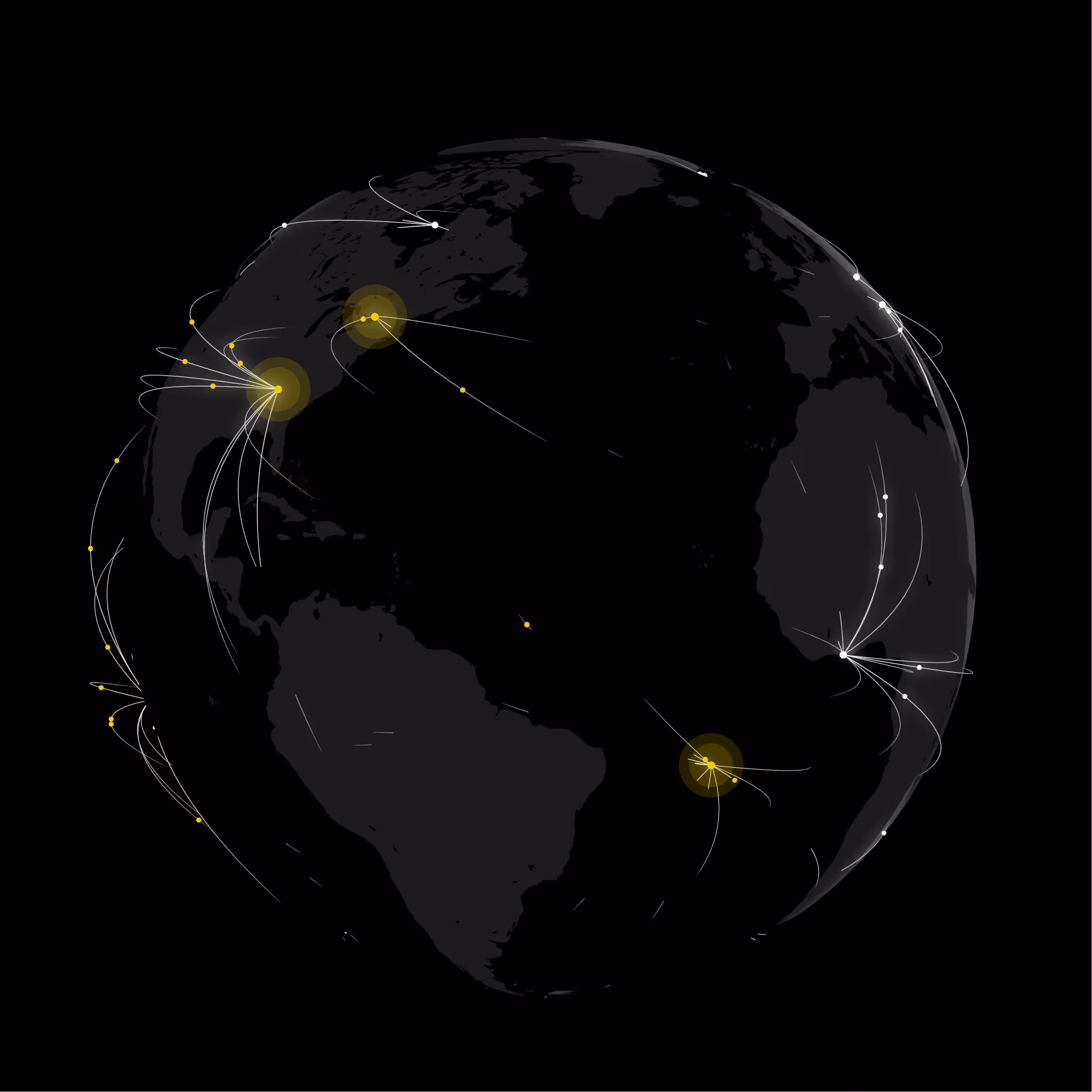
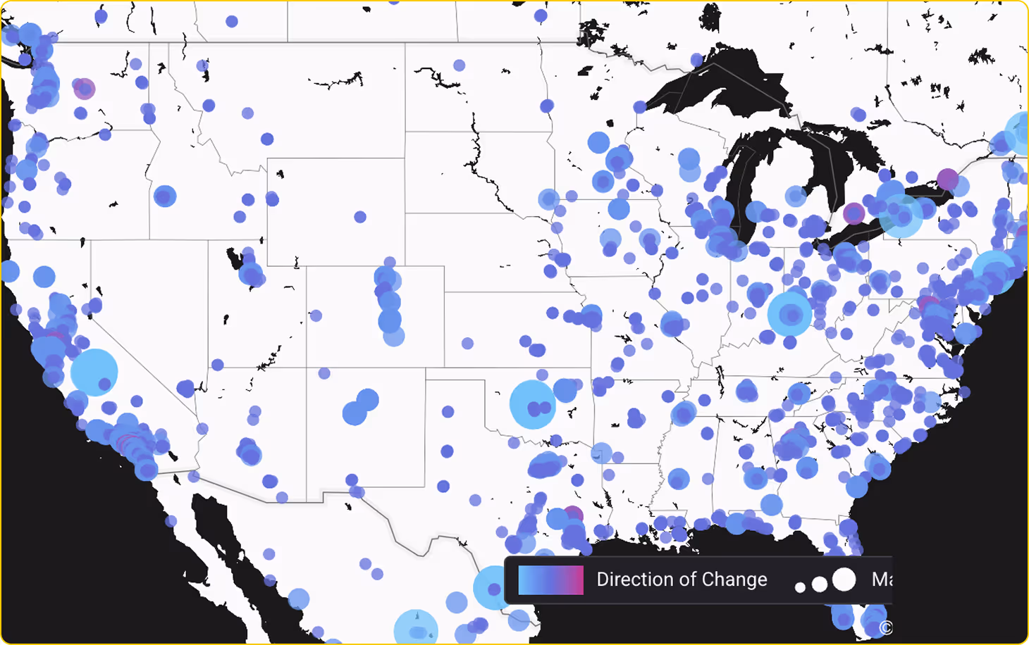
Create a common operating picture across agency boundaries.
Monitor and compare risk at any location across US states and countries at sub-mile granularity using BaseScore’s transparent 0-100 risk methodology. Brief leadership with objective metrics you can defend. Track how scores change over time to identify improving or deteriorating areas. Set policy thresholds for resource deployment based on quantifiable risk.


Trusted by proactive security leaders
Base Operations improved our executive security posture by enabling us to proactively identify threats and adjust security measures in both existing, remodeled, or newly acquired residential properties for senior executives. Nearby residential high net worth burglaries and break ins could have been a wake-up call too late. Instead, it became an opportunity to demonstrate the value of data-driven security planning.


Street level intelligence for EP teams is an absolute game-changer. If you're not aware of what this is, the implications, and how this benefits large full scope enterprise teams as well as individual operators, you're behind the curve. I highly recommend folks in the EP space check out Base Operations. Over the last 5+ years, the level of data collected, ingested and analyzed is nothing short of extremely impressive.

Base Operations informs our strategic and routine security planning across the world. The unmatched granularity of micro-intelligence supports our supply chain security planning and dramatically improves our travel security guidance.

Quickly became our key risk evaluation tool for event, travel, and office security. New use cases developed weekly from real estate to leadership insights. Great platform!

In the past 5 days I haven’t closed Base Operations. I give It a 10 out of 10.